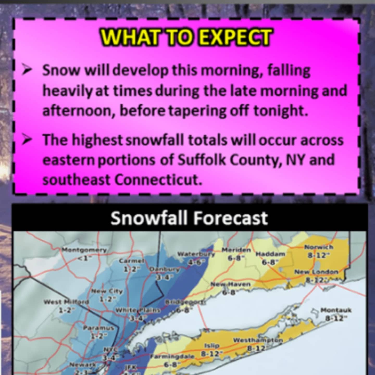

A coastal snow that is sweeping through the area Saturday is tracking farther west, meaning higher snowfall totals are expected, especially for areas south and east.
A Winter Weather Advisory is now in effect for Southern Westchester, which could see 4 or even as much as 5 or 6 inches of accumulation, according to the National Weather Service. The advisory is in effect until 1 a.m. Sunday.
A Winter Weather Advisory was then issued for Northern Westchester and Putnam until 10 p.m. Saturday and for Rockland until 9 p.m.
Snow began overspreading much of the area Saturday morning and has continued to fall moderately into the afternoon. It is expected to taper off in the evening in most of the Lower Hudson Valley. The window for snowfall should end around 10 p.m. Saturday.
Parts of Northern Westchester, Rockland and eastern Putnam could see 2-3 inches of accumulation. Most of Dutchess should see no more than an inch of accumulation, although eastern Dutchess could see 2-3 inches. (See graphic above.)
Sunday will be mostly sunny but bitterly cold with a high in the mid 20s and a wind-chill factor between zero and 10 degrees. Wind-chill advisories may be issued. There is a chance of some snow showers after 11a.m. Sunday.
Check back to Daily Voice for updates.
Click here to follow Daily Voice White Plains and receive free news updates.