The good news for Hudson Valley residents is that, with daytime highs in the upper 40s and even as high as 50 on Monday and Tuesday, the precipitation is expected to be all rain.
There will be a chance of rain in the afternoon on Friday, with a high in the lower 40s.
Saturday will be a partly sunny day with the high temperature climbing to around 50. There is a slight chance of early afternoon showers.
Sunday will be cloudy with rain possible at times during the day and likely during the evening and a high in the mid-40s.
Rain is likely overnight into Monday, with the low temperature will be in the mid-30s.
Monday will bring more rain with a high around 45 degrees.
The rain is expected to continue Monday night with a chance of more rain Tuesday and a high around 50.
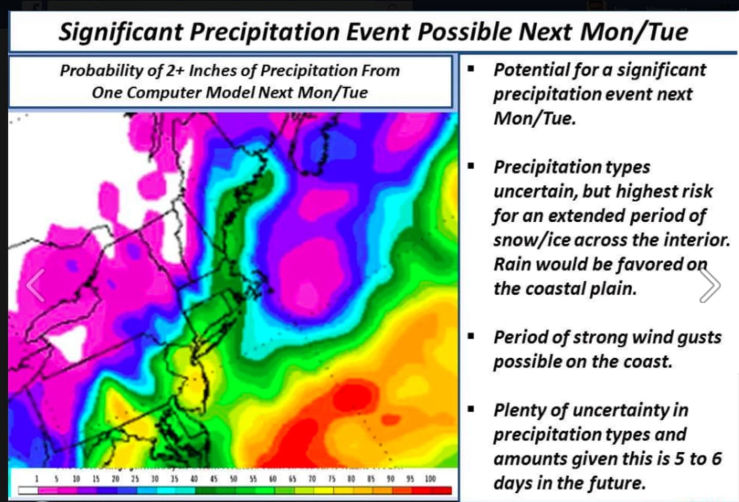
Some parts of the region, especially those closest to the coast, could see 2 inches or more of rainfall from the storm.
However, since the storm is four days away, a shift in the track could result in higher or lower amounts.
Check back to Daily Voice for updates.
Click here to follow Daily Voice White Plains and receive free news updates.