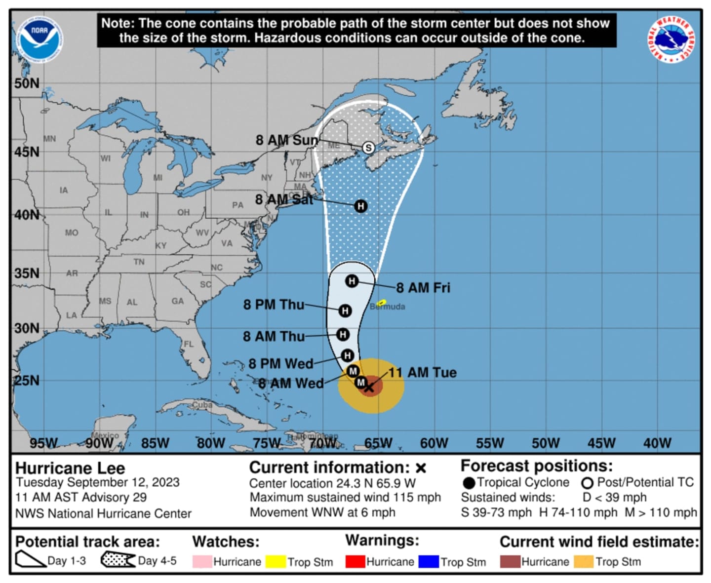
As of around 11 a.m. Tuesday, Sept. 12, Lee is located about 550 miles south of Bermuda with 115 mile-per-hour winds. A Category 3 storm on the Saffir-Simpson Hurricane Wind Scale, it's moving northwest at 6 miles per hour, the National Hurricane Center said.
Hurricane-force winds now extend 90 miles from Lee’s center, an increase from the weekend.
Some slowing is expected before it takes the northward turn prior to passing near but to the west of Bermuda on Thursday, Sept. 14, and Friday, Sept. 15.
A Tropical Storm Watch was issued for Bermuda late Tuesday morning.
It's expected to cause high surf, and dangerous rip current conditions from central Florida to Maine. Parts of eastern Massachusetts and Maine have been in Lee's forecast cone.
While landfall in New England is possible, the newest computer models show a more likely landfall in Nova Scotia, near Halifax, early Monday morning, Sept. 18. But landfall in Maine remains a possibility.
For a look at Lee's projected track through 8 a.m. Sunday, Sept. 17, see the image above from the National Hurricane Center.
Lee had hit Category 5 status late Thursday night, Sept. 7 before its wind speeds lowered.
View the 2023 list of Atlantic storm names here.
For more info on Tropical Storm Lee from the National Hurricane Center, click here.
The hurricane season began on Thursday, June 1, and ends on Thursday, Nov 30.
This continues to be a developing story. Check back to Daily Voice for updates.
Click here to follow Daily Voice White Plains and receive free news updates.