
This comes as little surprise considering that the disease is named for the place where it was first diagnosed in Lyme, Connecticut.
High awareness in the region comes due to the terrible side effects that come with Lyme and to other extents the similarly caused erlichiosis, anaplasmosis and babesiosis.
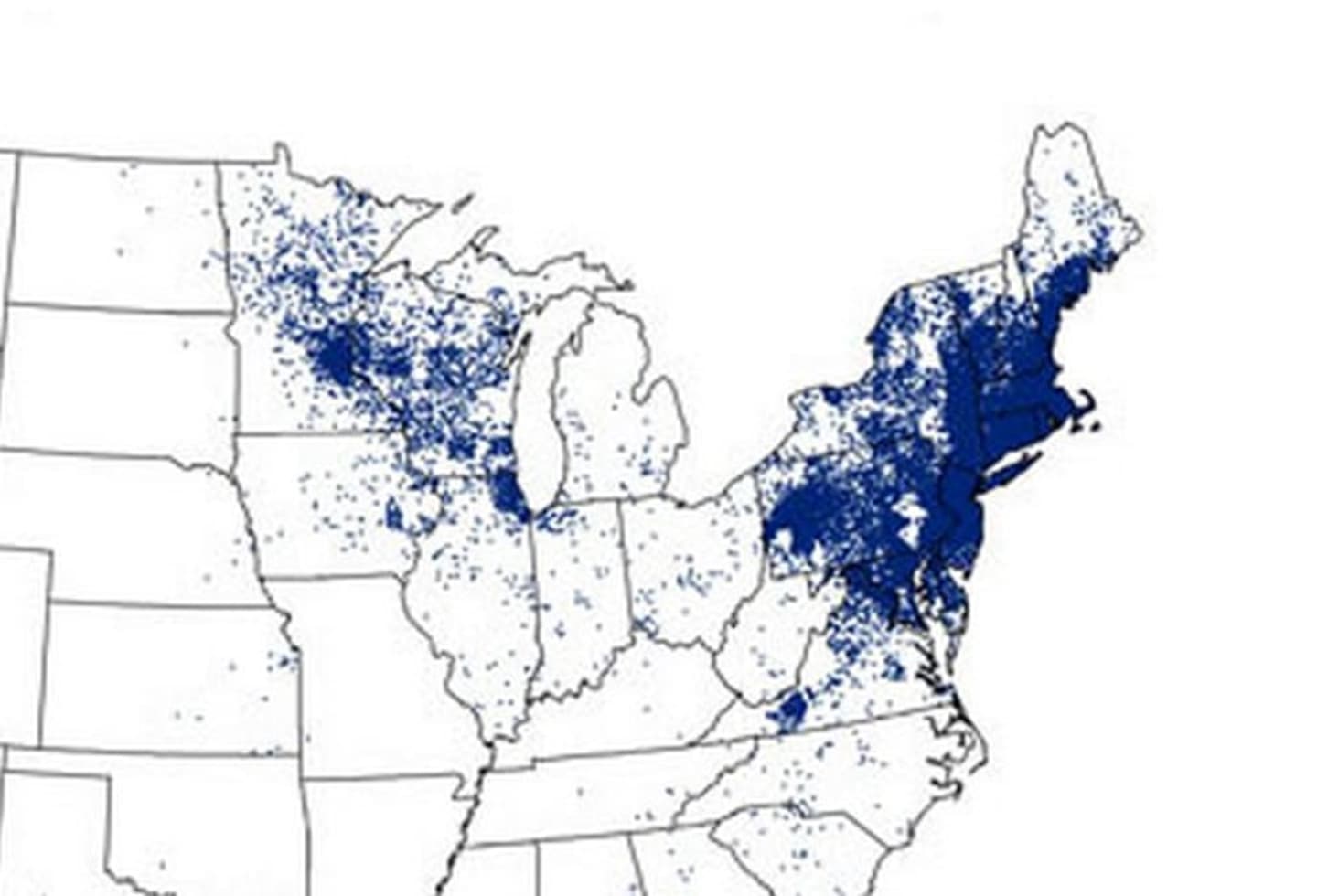
Older maps by the CDC pinpointed one spot per occurrence but the latest iteration shows the risk level of catching the disease, which causes arthritis and neurological problems, by county reports National Geographic.
The maps shows increases in cases. In 1993, 69 counties in the country qualified as high-risk areas. In 2012 there were 260 which is a 400 percent increase.
In 1993 high-risk counties were concentrated in Connecticut, New York and New Jersey, and to a smaller extent western Wisconsin. The most recent data shows high-risk areas in 17 states and expanding, according to National Geographic.
Click here to read the full story at National Geographic.
Click here to follow Daily Voice White Plains and receive free news updates.