The system should make its powerful presence felt for at least 24 hours, starting in the early morning hours on Thursday.
A Winter Storm Warning, which went into effect at midnight, will last until 6 a.m. Friday.
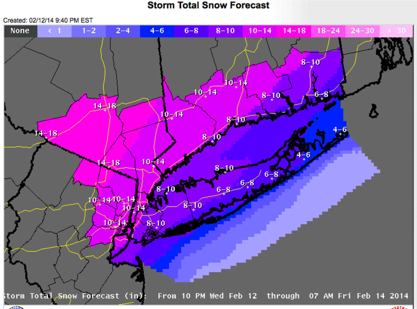
A total of 10 to 14 inches of snow is expected to fall across all of Westchester County after the National Weather Service increased its forecast snow totals late Wednesday afternoon. The extreme northwestern portion of Westchester could get as much 14 to 18 inches. Some areas further north and west could see even more snowfall while areas closer to the coast are expected to see a changeover to rain during the day and much less snow.
Snow could be heavy at times Thursday morning, falling at the rate of 2 to 3 inches per hour in some spots. Portions of the county could also see Thundersnow.
The storm is expected to wreak havoc with morning travel and has already resulted in the closures of schools, businesses and stores across the area. Travel conditions will be treacherous.
Metro-North announced Wednesday that it will be operating on a reduced schedule Thursday.
Gov. Andrew Cuomo reported Wednesday that New York State has 1,789 plows, 359 loaders and 4,185 operators ready for storm duty, as well as 291,000 tons of salt. Cuomo, who has activated the State Emergency Operation Center, urged New Yorkers to consider staying home Thursday.
Temperatures will be in the upper 20s to low 30s, with northeast winds of 10 to 20 mph and gusts of up to 30 mph.
The heavy, wet snow combined with gusting winds could cause trees and power lines to fall and cause weak, flat roof structures to collapse.
There is a gale warning in effect as well for Long Island Sound.
Periods of snow should continue until around the early morning hours of Friday.
The melting will begin early, with the outlook for Friday, Valentine’s Day, calling for sunny skies during the day and a high in the upper 30s.
Click here to follow Daily Voice White Plains and receive free news updates.